NASA’s Earth Observatory, a division that keeps an eye on changing climate and the environment around the globe, has uploaded the pre and post flood images of Pakistan.
Images clearly show the devastation that the monsoon rains caused throughout Pakistan during the first week of August.
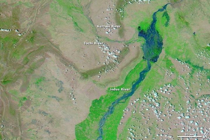
Check below the images, showing the abundance of flood water in various parts of the country.


The contrast reveals extensive flooding on the Kurram and Tochi River systems, which pour a cloud of sediment into the Indus River. Widespread floods also color the land east of the Indus River. Though these areas were among many experiencing flooding. However, the floods were not as severe as the destructive 2010 floods.
Just to mention, forecast says that situation in 2013 may worsen in last week of Monsoon. Clearly a disaster in the making.
Via NASA


Pakistan should also work on launching some weather / communication Satellites :-(
They can’t even utilize the current system fully. WTH they’ll do with satelite?
Run Windows 3.1 on core i7 extreme and 64 GB of Ram wont make your programs run fast.
Same is the case with Pakistan, its not the Apparatus that is faulty, its the people who are faulty,
yap agree with him
Agreed.
our Government should focus on flood protection dams and all that to tackle such situations
Only if they had started building kalabagh dam, things would’ve been a lot better in such situations….