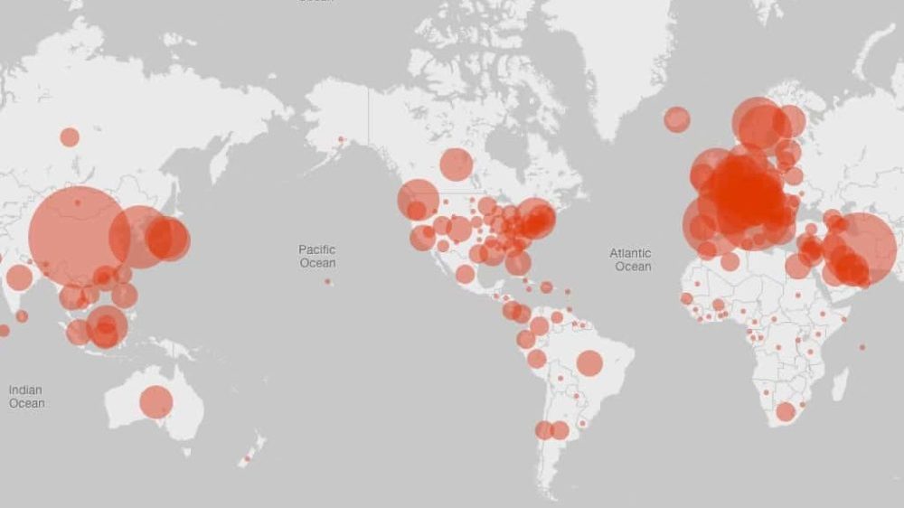
In its attempt to aid public health officials, Google is using the location data gathered from smartphones to identify the change in trends in terms of mobility. The data shown covers the past 48 to 72 hours, and the percentage reflects change between movement this month and late January.
Google explains:
As global communities respond to the COVID-19 pandemic, there has been an increasing emphasis on public health strategies, like social distancing measures, to slow the rate of transmission.
In Google Maps, we use aggregated, anonymized data showing how busy certain types of places are, helping identify when a local business tends to be the most crowded. We have heard from public health officials that this same type of aggregated, anonymized data could be helpful as they make critical decisions to combat COVID-19.
Of course, these reports use data from people who have opted for storing their location history with Google. The reports do not include personally identifiable information or show the number of visits to any particular category.
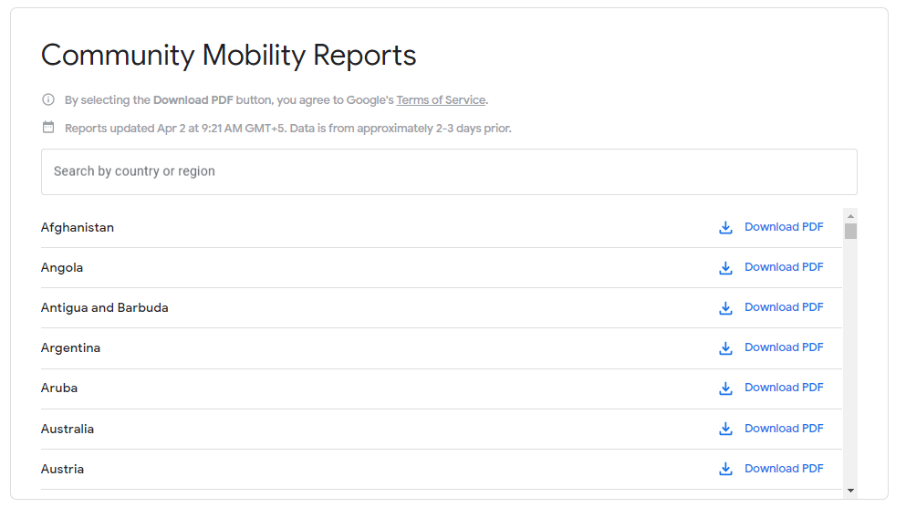
The COVID – 19 Community Mobility Reports cover 131 countries. It also allows anyone to search regional data, examining reports for individual states, provinces, and counties. After the required geographic region is selected, Google generates a PDF will detail of the collected data.
Movement patterns are divided into six categories in each report. These are:
- Retail and Recreation, i.e., places like restaurants, cafes, shopping centers, theme parks, museums, libraries, and movie theaters.
- Grocery and Pharmacy, i.e., places like grocery markets, food warehouses, farmers’ markets, specialty food shops, drug stores, and pharmacies.
- Parks, i.e., places like national parks, public beaches, marinas, dog parks, plazas, and public gardens.
- Transit stations, i.e., places like public transport hubs such as subway, bus, and train stations.
- Workplaces
- Residences
However, Google says:
We’ll leave a region out of the report if we don’t have statistically significant levels of data.
Government agencies and health officials around the world have asked tech companies to share more data to aid in the coronavirus response. These reports may help officials in understanding how well people are complying with the quarantine rules.
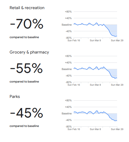
Mobility Report for Pakistan
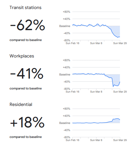
According to Pakistan’s mobility report by Google, there is, thankfully, a considerable change in the mobility trend. Retail and Recreational areas have seen a 70% fall in visits since 16 Feb 2020. As far as other categories are concerned, Grocery and Pharmacy, Parks, Transit stations, and Workplaces have seen 55%, 45%, 62%, and 41% downfall, respectively.
Holistically speaking, this is by no means bad, but considering the situation even a 45% decrease in mobility in parks is extremely disappointing. People should avoid leaving the house unless it is absolutely necessary, and it is best to opt out of all recreactional activities.
On the contrary, the Residential areas have seen an 18 percent raise, which, according to the ongoing situation, is not exactly ideal.
Google will regularly update the data as the trends change.


Hone Do Loases, Salo tak Kamaya bhi to hai Leking Nahi Iska Badla Employe ko nikal k karnege
Bhai ki jan! Every country has almost the same trend as Pakistan even the USA.
khuda da wasta
bing tn map da photo chack k title ty laya hoya e
jhotan di pand
Disable history in your Google account to fail Google :) Specially in Google Maps.
You can’t fool Google :)