Pakistan Meteorological Department has predicted more rain/snow in the country for the middle of the week.
Met Office informed that a westerly wave is likely to enter the western parts of the country on Tuesday (evening/night), and are likely to affect different parts of the country on Wednesday and may persist in the upper regions till Thursday. Under the influence of this weather system:
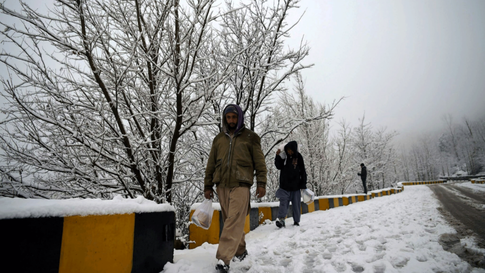
- Widespread rain-thunderstorm (with few moderate to isolated heavy falls) is expected in Upper Khyber Pakhtunkhwa (Malakand, Hazara, Peshawar, Kohat & Mardan divisions), Upper Punjab (Rawalpindi, Gujranwala, Sargodha, Lahore, Faisalabad divisions), Islamabad, Gilgit Baltistan, and Kashmir from Wednesday to Thursday (night). Snowfall over hills is also expected in Malakand division (Swat, Chitral, Kalam, Malamjabba & upper Dir), Hazara division, Murree, Galliyat, Kashmir and Gilgit-Baltistan during the period.
- Rain-thunderstorm is expected at scattered places in Lower Khyber Pakhtunkhwa (Bannu, D.I.Khan divisions) and Southern Punjab (Multan, Bahawalpur, D.G.Khan & Sahiwal divisions) during Wednesday/Thursday.
- Rain-thunderstorm (with snowfall over the hills) is expected at scattered places in Balochistan (Quetta, Zhob, Kalat, Makran, Naseerabad & Sibbi divisions), Sindh (Sukkur, Larkana, Shaheed Benazirabad, Hyderabad, Karachi divisions) on Wednesday.
Moderate to heavy falls are expected to trigger landslides in Malakand, Hazara divisions, Gilgit-Baltistan and Kashmir from Wednesday to Thursday.
Stay Connected with ProPakistani
Get the latest news and stories wherever you prefer.
Add ProPakistani to Preferred Sources and see more of our stories in Google Search and Top Stories.


