The future is already here with Google Maps’ new update that can scan the world around you to pinpoint locations, directions, and more. You simply have to scan your surrounding area through your phone camera and the app will label roads and locations for you through Augmented Reality (AR).
This feature is called AR-based Live View search and it was announced for Maps back in September this year. Google is finally rolling out the promised update, but it will only be available in select cities around the world for now. These cities include London, New York, Paris, San Fransico, Tokyo, and Los Angeles.
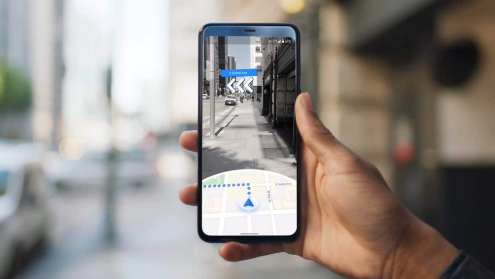
As mentioned earlier, Live View mode will add overlays on top of your surroundings, add points to landmarks, or label other places you are looking for. Here is what it looks like.
The feature is powered by AI and AR as well as billions of street-view images that have mapped the world over the past years. It aims to give you a much better grasp of your surroundings, which should especially be useful if you are unfamiliar with the area. It can show banks, restaurants, ATMs, shops, and more, even if the location is not in sight yet or is around the corner.
The labels on these locations will have useful information such as busy hours, the price range of products, ratings, and whether it’s open or not. For instance, if you are looking for EV charging stations, it will show you compatible and fast charging ones above 50kW.
Wheelchair-accessible search is also rolling out to more regions across the globe with this update. It was only available in Australia, Japan, the UK, and the US initially.
Google is rolling out the new update next week on iOS and Android devices.
Stay Connected with ProPakistani
Get the latest tech news, telecom insights, and product launches wherever you prefer.
Add ProPakistani to Preferred Sources and see more of our stories in Google Search and Top Stories.


