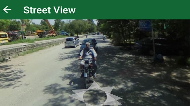
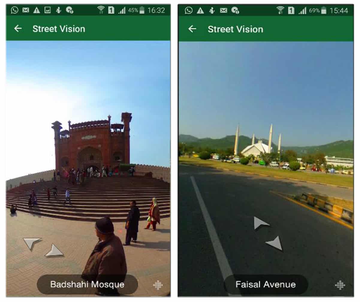
TPL Maps today announced that it has launched street view maps for three cities of Pakistan.
This new facility, which is patchy and shows images for selected spots only, will enable users to virtually view the streets and roads of Islamabad, Lahore and Karachi.
TPL maps claims that this is the first of its kind feature being launched in Pakistan and that its a technology breakthrough by any mapping company in the country.
TPL maps said that its street view vision includes 60,000+ images for three top cities of Pakistan. It said that feature will be stretched to other major cities of Pakistan in the future including Quetta, Peshawar, Faisalabad and other cities in the span of next few months.
Just in case if you are wondering, street-view maps are not privacy proof for now. They are primarily the images shot with 360 degree camera and can be rotated to view panoramic view with zoom.
TPL Maps already offers Satellite View and Night Mode options as part of the free app offering.
Company said that it also plans to crowd-source street-images to include those in its street view mapping functionality.
TPL maps are available for both android and iOS.
Stay Connected with ProPakistani
Get the latest news, tech updates, telecom insights, and business stories wherever you prefer.
Add ProPakistani to Preferred Sources and see more of our stories in Google Search and Top Stories.


Great
Good Stuff (Y)
TPL stands for what? I waiting for street view in google maps for Pakistan
Trakker Pakistan Limited
No driving mod
will be
nice
Very good Act. By TPL
I expected Google map’s to do this street view in Pakistan but we’ll done to our own TPL map’s who took this step in Pakistan yes County like Pakistan it is security issue but we have to move forward every country have it even for example you at at satellite image of London and in Lahore you will see massive change in London image u will see HD image taken from satellite in Pakistan Lahore very bad quality so Google never improved Pakistan map’s from many year’s so good step taken from TPL although it need massive improvements to take over Gmaps
Stupid initiative…. u could just update Google Maps instead more accurately as everyone in the world will be using that.
–!!!!
That’s what I call Pro Pakistani
WOW!
amazing, some unbelievable features
Pathetic app….
Glad with the initiative for their depth. We’ve to look at the IPR aspect before using it, as the technology be original, not cut and paste. Which is being tracked and watched by the oiginal licensee. Today many are confused.
Stupid initiative…. u could just update Google Maps instead more accurately as everyone in the world will be using that.
— plz
Stupid initiative…. u could just update Google Maps instead more accurately as everyone in the world will be using that.
—