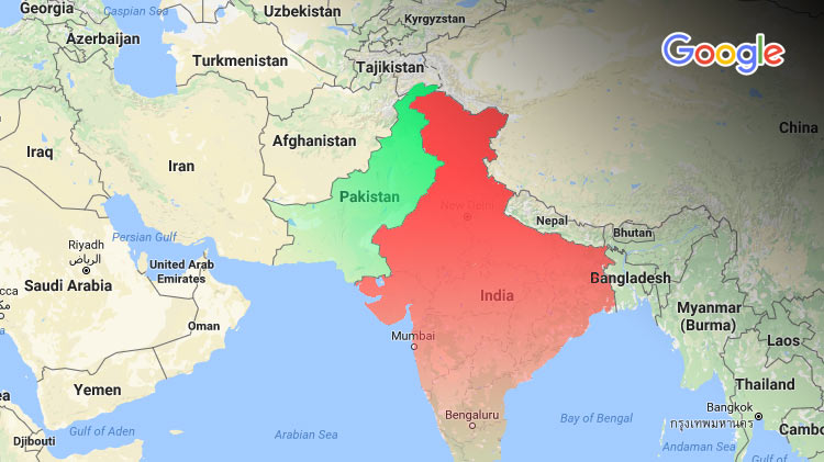
All internationally recognized maps portray Kashmir as Indian territory. The demarcation could be dismissed as a mistake — the territory is disputed — but Google Maps depicts Gilgit-Baltistan as a part of India too. The blunder is an offense to state integrity, and members of the National Assembly discussed it on Thursday.
PTI Lawmakers Request Action
Google Maps is privately owned, and Pakistan does not have much influence over it. This provides reason to believe that not much can be done.
But assembly members persist: wrongful demarcation extends to all international maps. The misinformation could be used by students in journals and academia. It would misrepresent the status of Pakistan as an independent state. Matters could get out of hand.
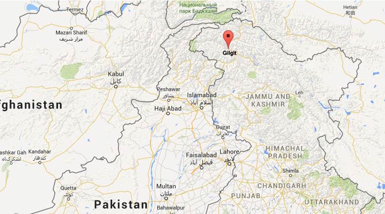
The problem has existed since 2016 after a high-resolution upgrade. It is interesting to note that maps only display Gilgit Baltistan as Indian territory outside of Pakistan. The following screengrab was taken from a “co.in” domain:
The Minister of State and Frontier Regions Abdul Qadir Baloch called it “evil” and expressed his distress:
“India will spare no opportunity to embarrass Pakistan on international forums.”
But he said Pakistan would respond. The Foreign Office would take steps to protect the state interest and discourage conspiracy against the country.
ALSO READ
Google is Showing K2, Muzzafarabad, Skardu, Gilgit as Part of India
India faced a similar issue but after the country’s courts forced Google to follow the government accepted maps for users in India. Pakistan could follow suit and force Google to display maps that comply with local laws.
Recommendations
The lower house was unconvinced. PTI’s Shehryar Afridi recommended a display of apprehension to international forums. He proposed legal measures to tackle the issue. Dr Shireen Mazari, also from PTI, demanded more tangible solutions:
- to prevent future errors, the Survey of Pakistan should improve maps
- the government should temporarily block Pakistan’s maps to Google
The idea is inconceivable, but Google Maps is singularly at fault — and this is not its first. The tech giant erased Palestine from maps in 2016, and placed China’s Hotan County in Indian territory before that. Perhaps it should purchase an Atlas.
Stay Connected with ProPakistani
Get the latest tech news, telecom insights, and product launches wherever you prefer.
Add ProPakistani to Preferred Sources and see more of our stories in Google Search and Top Stories.


“Perhaps it should purchase an Atlas”, or be honest in their approach.
just checked from US / IN and PK , map is showing disputed
even Aksai Chin
https://uploads.disquscdn.com/images/dff07bac49a1db7145fc65cc320a062657aa8438632276845524b867da1b5303.jpg
its an American Policy/Pressure to Show our CPAC rout access as disputed area…
It should be handled through legislation instead of banning Google services at once.
Please elaborate your concept behind this. How do you want to handle it through legislation.
they are just pressurizing us. showing that Gilgit Baltistan is a disputed area, for the cause of CPEC. but then who cares, this kind of things just show how cynical the google map is and yes google is proving it self a non-conform and non-solid source of information! so lets play their game!!
I just checked google maps locally and it shows dotted line, meaning this area is also disputed.